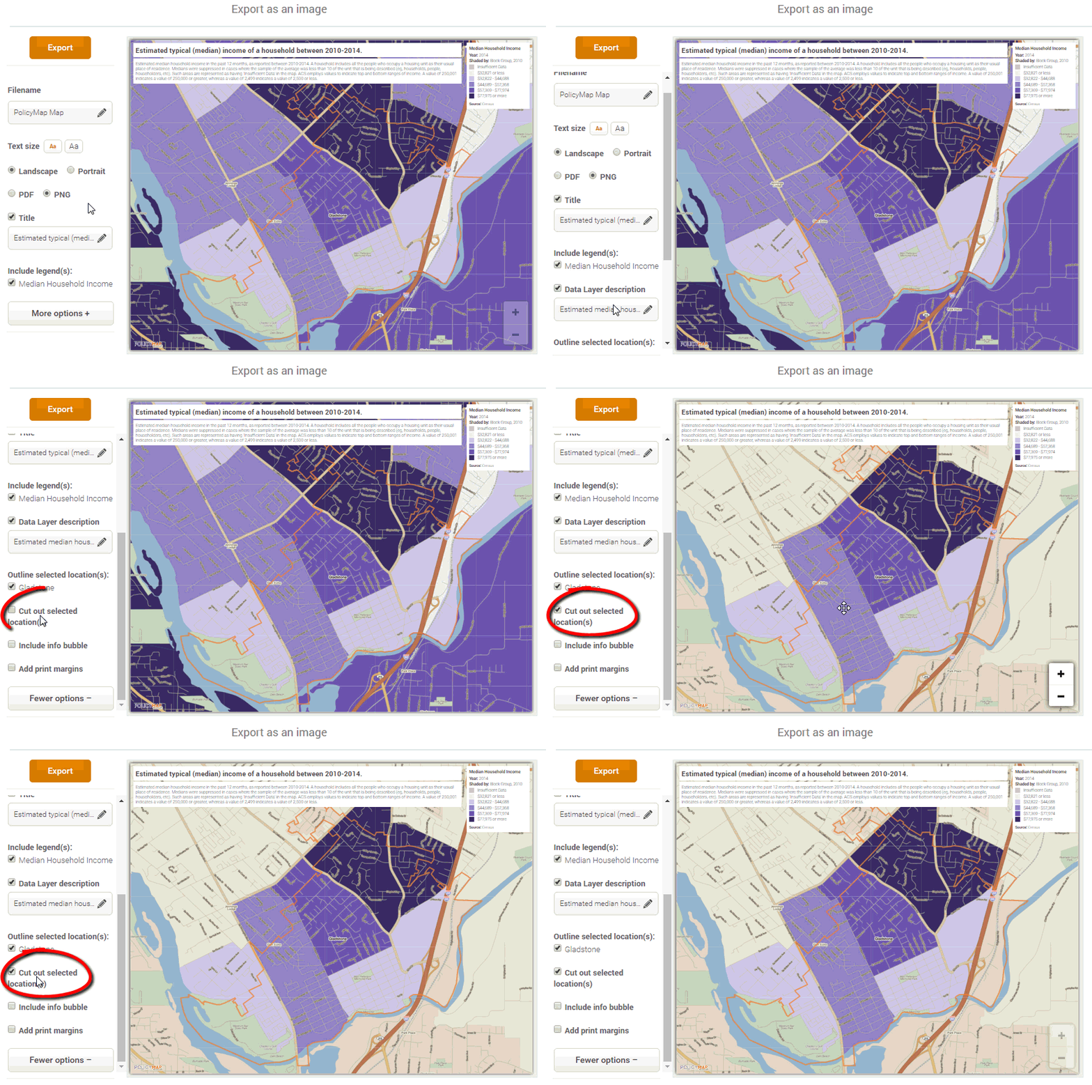
Did you know you can print a map of just your target area shaded and have the surrounding area clear? We call this print option “cut out location”, or sometimes called Island Printing. To use this feature:
Map of only Chicago shaded
Subscribers can choose to have an island printed map of just their target area (or custom region) shaded. Just load your custom region from the Maps page or from My Saved Work, load the data layer and data points to display on the map, and print using the “cut out selected location” checkbox marked off.
Map of only custom region shaded
If you have any questions or want to lean more, visit our training calendar and attend a free session or contact us at any time.
To read a full guide on all features on PolicyMap, please look at our Primer available here