If you are searching for Anarctic Ice Sheet datasets, visit the Antarctic Ice Sheet Datasets page. If you are interested in paleo datasets, visit the Paleo Datasets page.
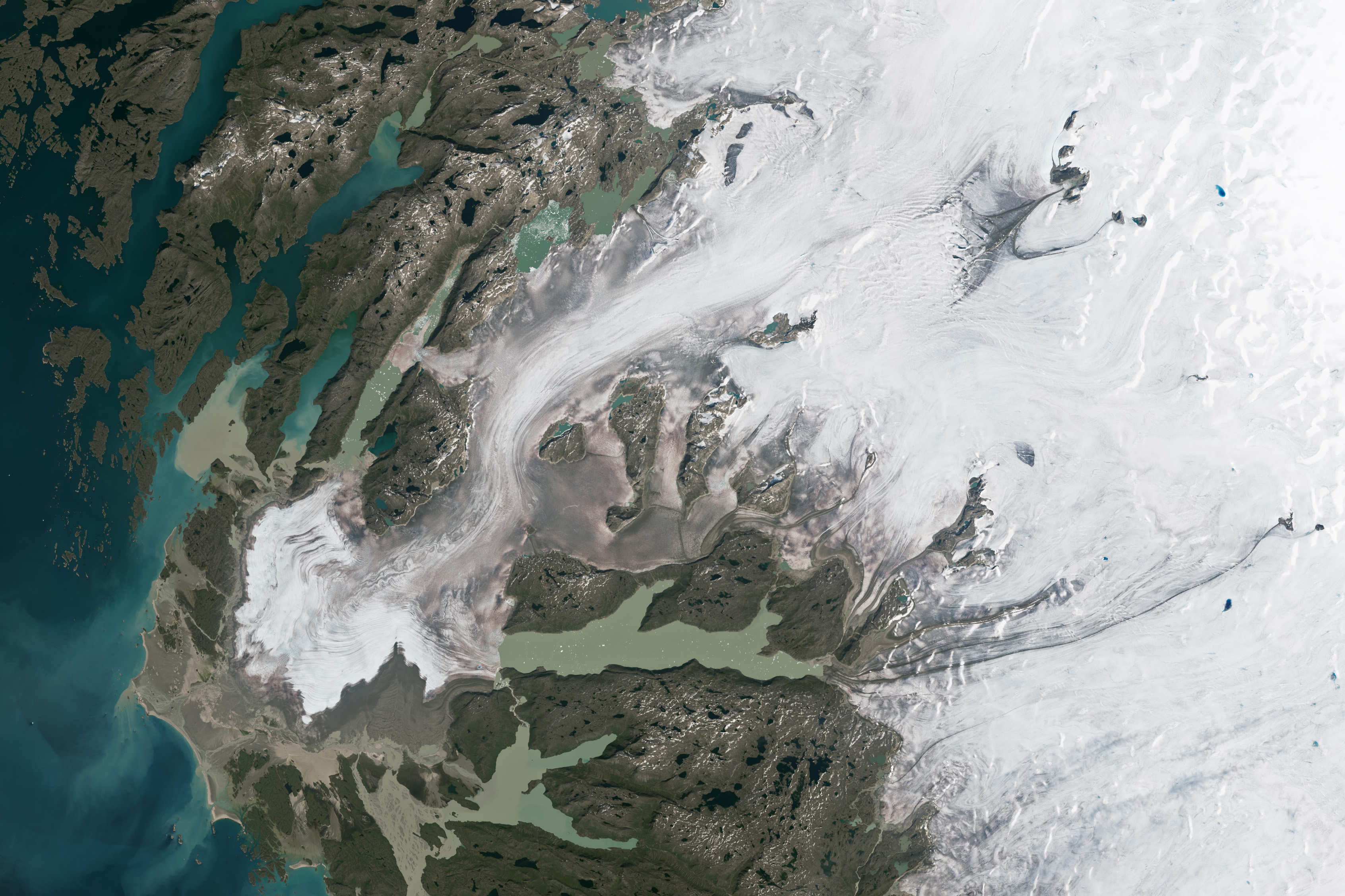
Frederikshåb Glacier, Greenland; Landsat-8 True Image \n Image Credit: NASA/USGS
Ice sheet boundaries reveal important information about ice sheet dynamics. This ice sheet boundary inventory is not representative of all available datasets, but some of the most utilized datasets.
ID: GIMP NSIDC Landing page \n Description: A link to the data repository hosted on NSIDC for the MEaSUREs Greenland Land Ice and Ocean Classification Masks \n Data Format: GeoTIFF \n Spatial Resolution: 15 m, 30 m, 90 m \n Projection: EPSG:3413 – WGS 84 / NSIDC Sea Ice Polar Stereographic North \n Sensor: Enhanced Thematic Mapper Plus (EMT+) \n Platform: Landsat-7 \n Coverage Period: 1999-2002 and 2013-2015 \n
ID: GEUS Dataverse download portal \n Description: Mapping products of the extent of the NW Greenland Ice Sheet sector from multiple sources as part of PROMICE (Programme for Monitoring of the Greenland Ice Sheet) \n Data Format: ESRI Shapefile (vector) \n Spatial Resolution: Varied \n Projection: EPSG:3264 – WGS 84 / UTM Zone 24N \n \n 1. 1985 Extent – Derived from orthophotos from stereophotogrammetric imagery taken in 1985 \n Sensor: WILD RC10 camera and WILD Super Aviogon-II lens \n Platform: Not described \n Coverage Period: 1985 \n \n 2. CCI – Includes peripheral glaciers and ice caps with strong connections to the GrIS; outline is based on Landsat-7 imagery \n Sensor: Enhanced Thematic Mapper Plus (ETM+) \n Platform: Landsat-7 \n Coverage Period: 2000-2002 \n \n \n 3. GIMP – Derived from image mosaic from Landsat-7 and RADARSAT-1 imagery \n Sensor: Enhanced Thematic Mapper Plus (ETM+), Synthetic Aperture Radar (SAR) \n Platform: Landsat-7, RADARSAT-1 \n Coverage Period: 1999-2001 \n \n \n 4. Rignot dataset – NW sector modified to exclude ice sheet margins north of 76°48'N and 67°0'W \n Sensor: Not described \n Platform: Not described \n Coverage Period: 2007-2008 \n \n
ID: gi_rgi05_003 \n Description: Includes peripheral glaciers and ice caps with strong connection to the ice sheet \n Data Format: Vector (polygon), shapefile \n Spatial Resolution: 30 m \n Projection: EPSG: 4326 \n Sensor: Thematic Mapper (TM), Enhanced Thematic Mapper Plus (EMT+) \n Platform: Landsat-5, Landsat-7 \n Coverage Period: 1994-2009 \n
Ice sheet elevation reveals important information about changing ice sheet dynamics, such as mass balance. This ice sheet elevation inventory is not representative of all available datasets, but some of the most utilized datasets.
ID: NSIDC-0092 \n Description: Combination of ERS-1 and Geosat satellite radar altimetry data, ATM data, and photogrammetric digital height data \n Data Format: TIFF, IMG, Binary, ASCII \n Spatial Resolution: 5 km x 5 km \n Projection: Not specified \n Sensor: Altimeters, Advanced Thematic Mapper (ATM), Radar altimeters, Radar echo sounders \n Platform: Aircraft, Geosat \n Coverage Period: 1970, 1993-1999 \n
ID: IDBMG4 \n Description: Bed topography and bathymetry map of Greenland based on mass conservation and ocean bathymetry data (see BedMachine documentation ) \n Data Format: NetCDF, GeoTIFF \n Spatial Resolution: 150 m x 150 m \n Projection: WGS 84 / NSIDC Sea Ice Polar Stereographic North \n Sensor: Multichannel Coherent Radar Depth Sounder (MCoRDS) \n Platform: NASA DC-8, P-3B \n Coverage Period: 1993-2021 \n
ID: NSIDC-0715 \n Description: DEM derived from imagery collected by GeoEye-1, WorldView-1, -2, and -3 satellites (see GrIMP DEM documentation ) \n Data Format: GeoTIFF \n Spatial Resolution: 30 m x 30 m \n Projection: WGS 84 / NSIDC Sea Ice Polar Stereographic North (EPSG:3413) \n Sensor: CAMERAS \n Platform: GeoEye-1, WorldView-1, WorldView-2, WorldView-3 \n Coverage Period: 2008-2020 \n
ID: Not Specified \n Description: IceBridge ATM L2 Icessn Elevation, Slope, and Roughness data organized into individual flight lines \n Data Format: Shapefile, ASCII \n Spatial Resolution: Not specified \n Projection: Not specified \n Sensor: C-130, DC-8, G-V, HU-25A, HU-25C, P-3B, WP-3D ORION \n Platform: Airborne Topographic Mapper (ATM) \n Coverage Period: 1993-2019 \n
Ice sheet velocity reveal important information about changing ice sheet dynamics. This ice sheet velocity inventory is not representative of all available datasets, but some of the most utilized datasets.
ID: NSIDC-0670 \n Description: Multi-year ice sheet-wide velocity mosaic derived from InSAR, SAR, and OLI imagery (see MEaSUREs velocity documentation ) \n Data Format: GeoTIFF, JPEG \n Spatial Resolution: 250 m \n Projection: WGS 84 / NSIDC Sea Ice Polar Stereographic North (EPSG:3413) \n Sensor: Operational Land Imager (OLI), Interferometric Synthetic Aperture Radar (InSAR), Synthetic Aperture Radar (SAR) \n Platform: Landsat-8, RADARSAT 1 and 2, ALOS PALSAR, TerraSAR-X (TSX)/TanDEM-X (TDX), ERS-1/2 \n Coverage Period: 1995-2015 \n
ID: Not Specified \n Description: Timeseries of Greenland Ice Sheet velocity mosaics derived from the European Space Agency (ESA) 's Sentinel-1 SAR \n Data Format: PNG with accompanying NetCDF \n Spatial Resolution: 200 m \n Projection: Polar Stereographic projection (EPSG: 3413) \n Sensor: Synthetic Aperture Radar (SAR) \n Platform: Sentinel-1 \n Coverage Period: 2016 to present \n
ID: NSIDC-0481 \n Description: Velocity estimates derived from SAR data for glacier outlet areas \n Data Format: GeoTIFF, JPEG \n Spatial Resolution: 100 m \n Projection: WGS 84 / NSIDC Sea Ice Polar Stereographic North (EPSG:3413) \n Sensor: Synthetic Aperture Radar (SAR) \n Platform: TerraSAR-X/ TanDEM-x (TSX/TDX) \n Coverage Period: 2008-2023 \n
Ice sheet gravity reveal important information about changing ice sheet dynamics. This ice sheet gravity inventory is not representative of all available datasets, but some of the most utilized datasets.
ID: IGGRV1B \n Description: Measurements collected from Sander Geophysics AIRGrav (airborne gravity system), as part of Operation IceBridge \n Data Format: XML, ASCII \n Spatial Resolution: 5 km to 7 km \n Projection: WGS 84 / NSIDC Sea Ice Polar Stereographic North (EPSG:3413) | WGS 84 / Antarctic Polar Stereographic (EPSG:3031) \n Sensor: AIRGrav \n Platform: DC-8, P-38 \n Coverage Period: 2009-2018 \n