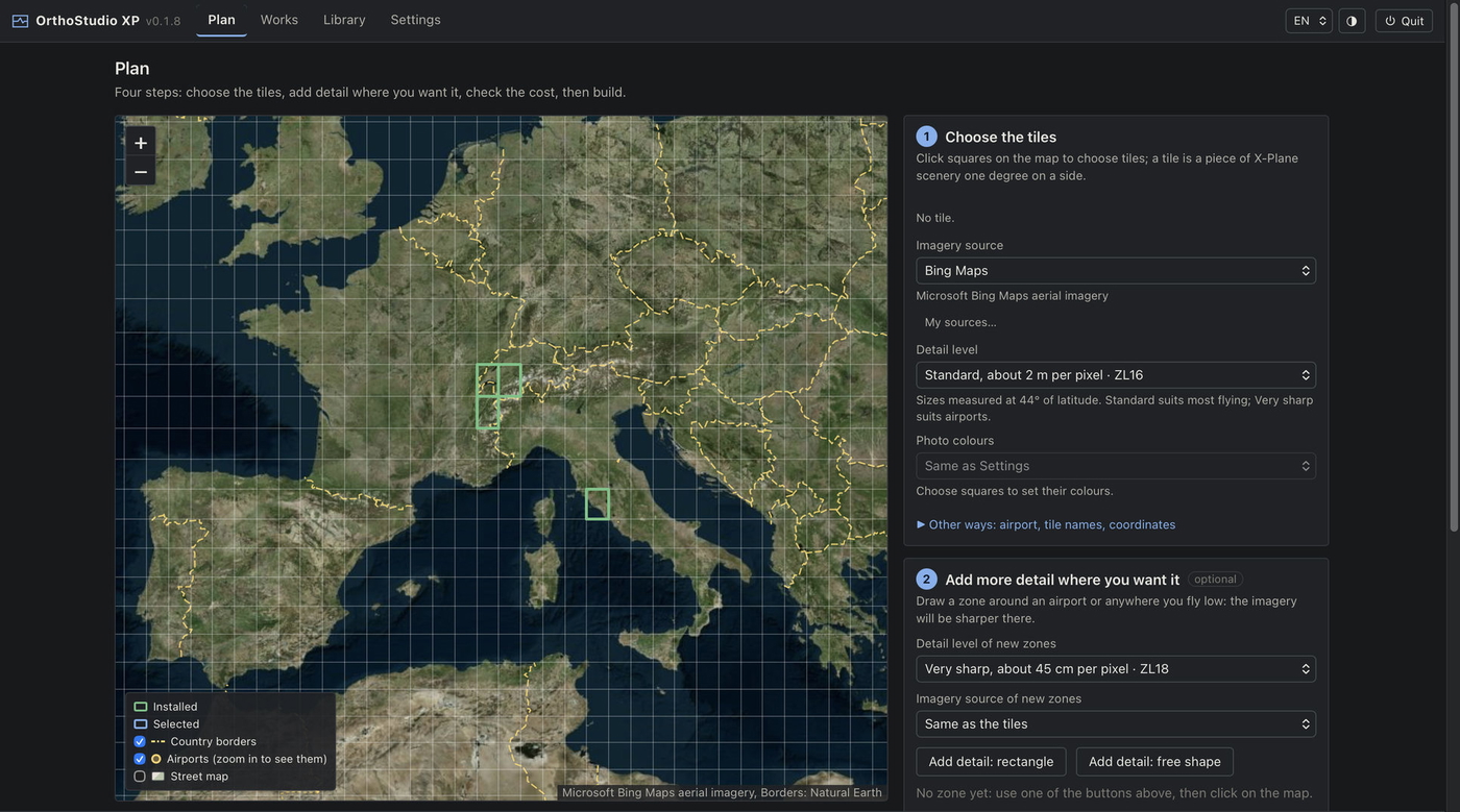
OrthoStudio XP builds orthophoto scenery for X-Plane 12 (XP12): aerial imagery laid on the real relief, tile by tile, from a page that says in plain words what it is doing.
It is a new program built on the rules of Ortho4XP, which Oscar Pilote and its contributors have refined for ten years: it makes the same kind of tiles, with a different architecture that builds them faster. It would not exist without Ortho4XP. It is an independent project, not made or endorsed by the Ortho4XP authors.
This is a beta (0.1.17). Please read the known limitations below, and report what you find.
An example: six ZL16 tiles around Lake Geneva (1,347 textures, 4.64 GB) were built and installed in 5 min 22 s on an Apple M4 Pro, over a 132 Mbit/s home connection.
Opening OrthoStudio XP shows its page in a window of its own, which works like any window on your system; opening it again brings that window back. Quitting stops the engine, and asks first when a build is running: what was already built is kept, so building again carries on from there. On Linux it opens in your browser instead. Quit X-Plane before installing or removing tiles: X-Plane reads new scenery when it starts.
For your own use : the imagery and the map data come from public services whose terms apply to you. Do not share or sell the tiles you build.
Reporting a problem : please open an issue on GitHub, whose form asks for what helps find the cause (the version, your system, the tile, a screenshot and the log serve.log ): https://github.com/radioharris/orthostudio-xp/issues/new/choose . Without a GitHub account, a comment here works too.
Source code, documentation and every version: https://github.com/radioharris/orthostudio-xp
Licence and credits : GPL v3, as a derivative of Ortho4XP; thanks to Oscar Pilote and its contributors. Triangle4XP (Jonathan Shewchuk's Triangle, modified by Oscar Pilote; free of charge, not for commercial use). DSFTool (Laminar Research, MIT/X11). Map data © OpenStreetMap contributors (ODbL); the street map is rendered by OpenFreeMap (© OpenMapTiles). Borders: Natural Earth. Map libraries: Leaflet and MapLibre GL.